
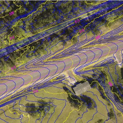
DeKalb Avenue
DeKalb Avenue (2018)
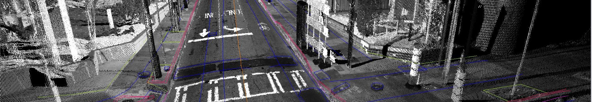
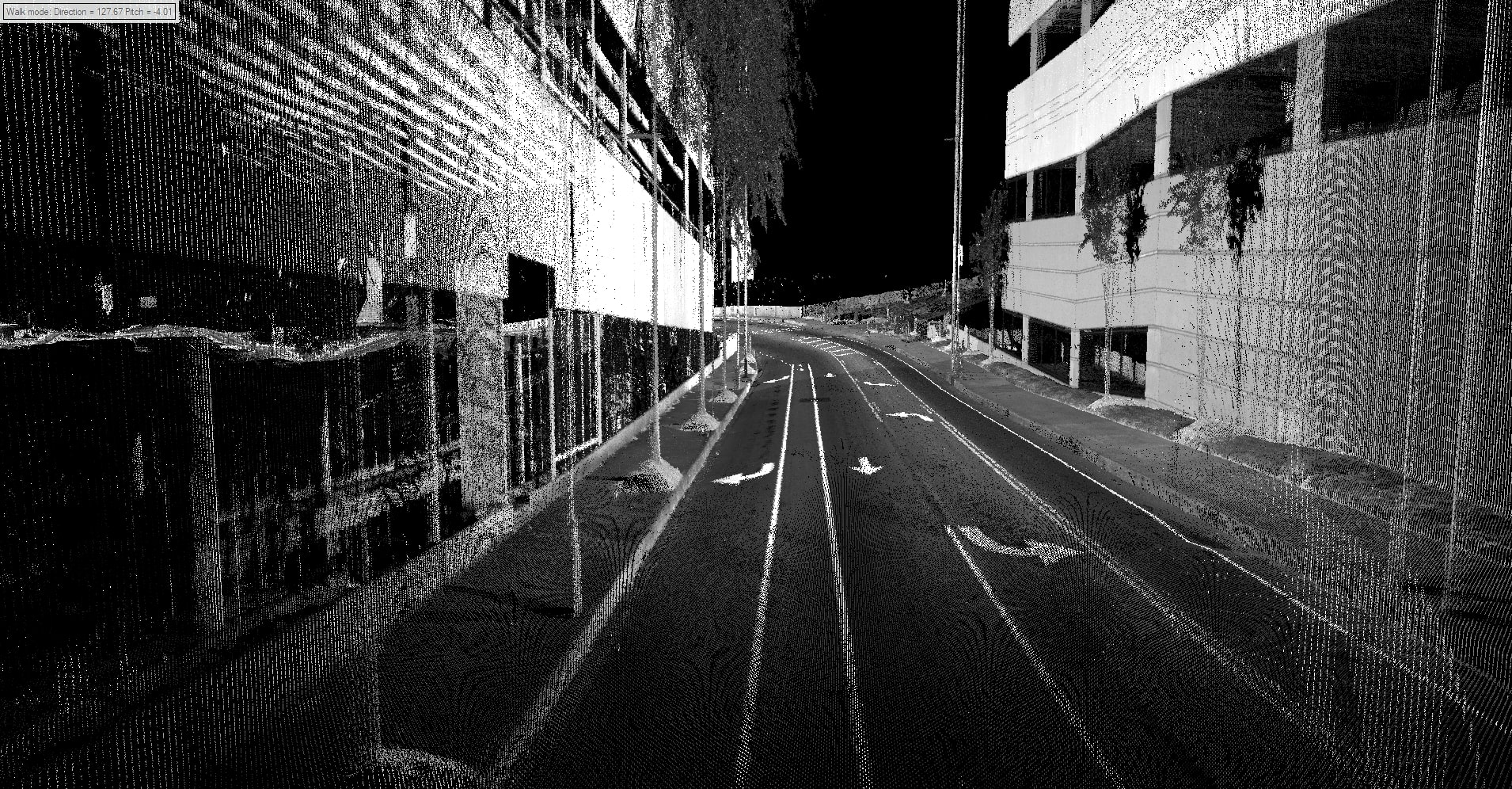
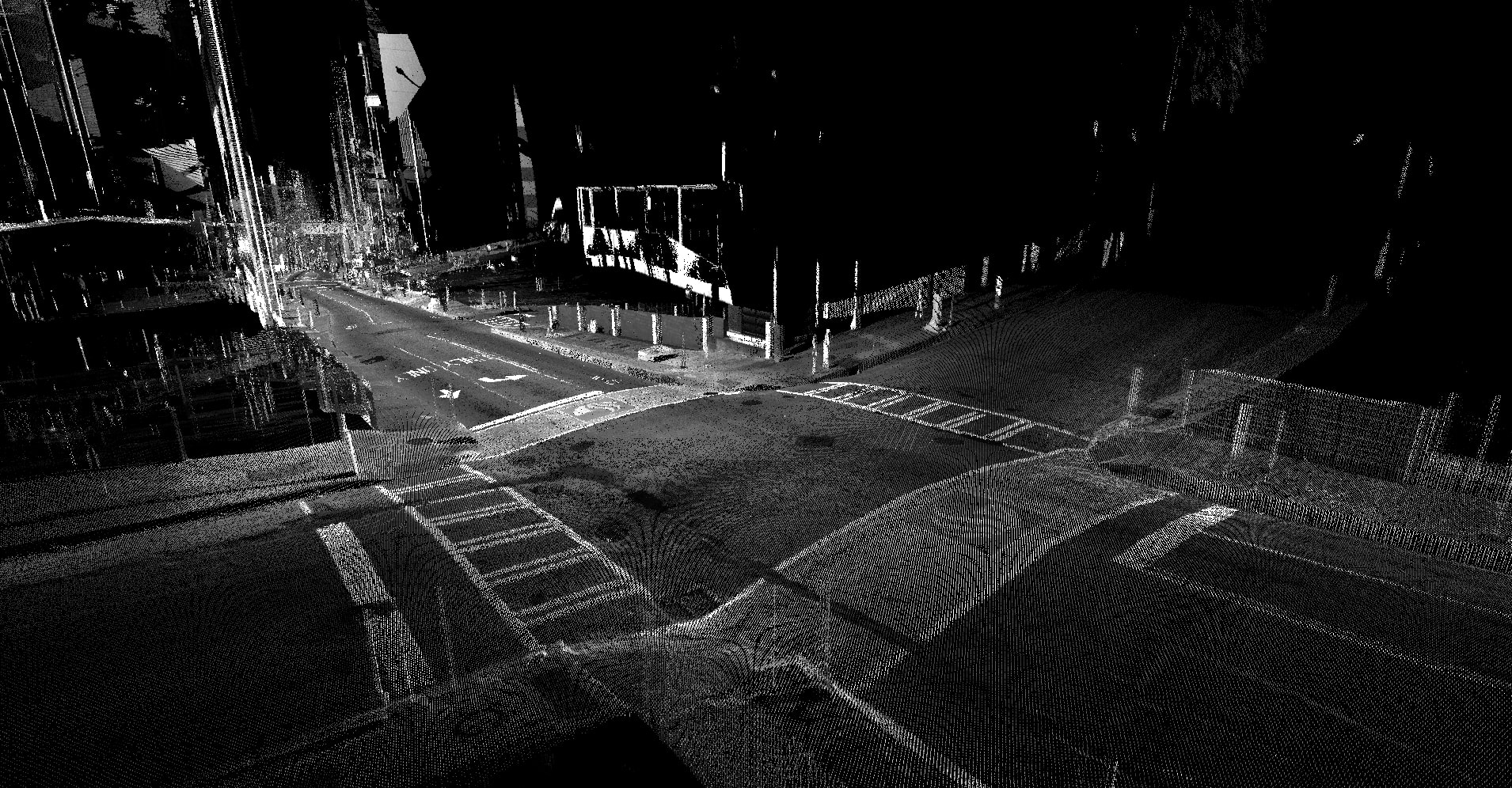
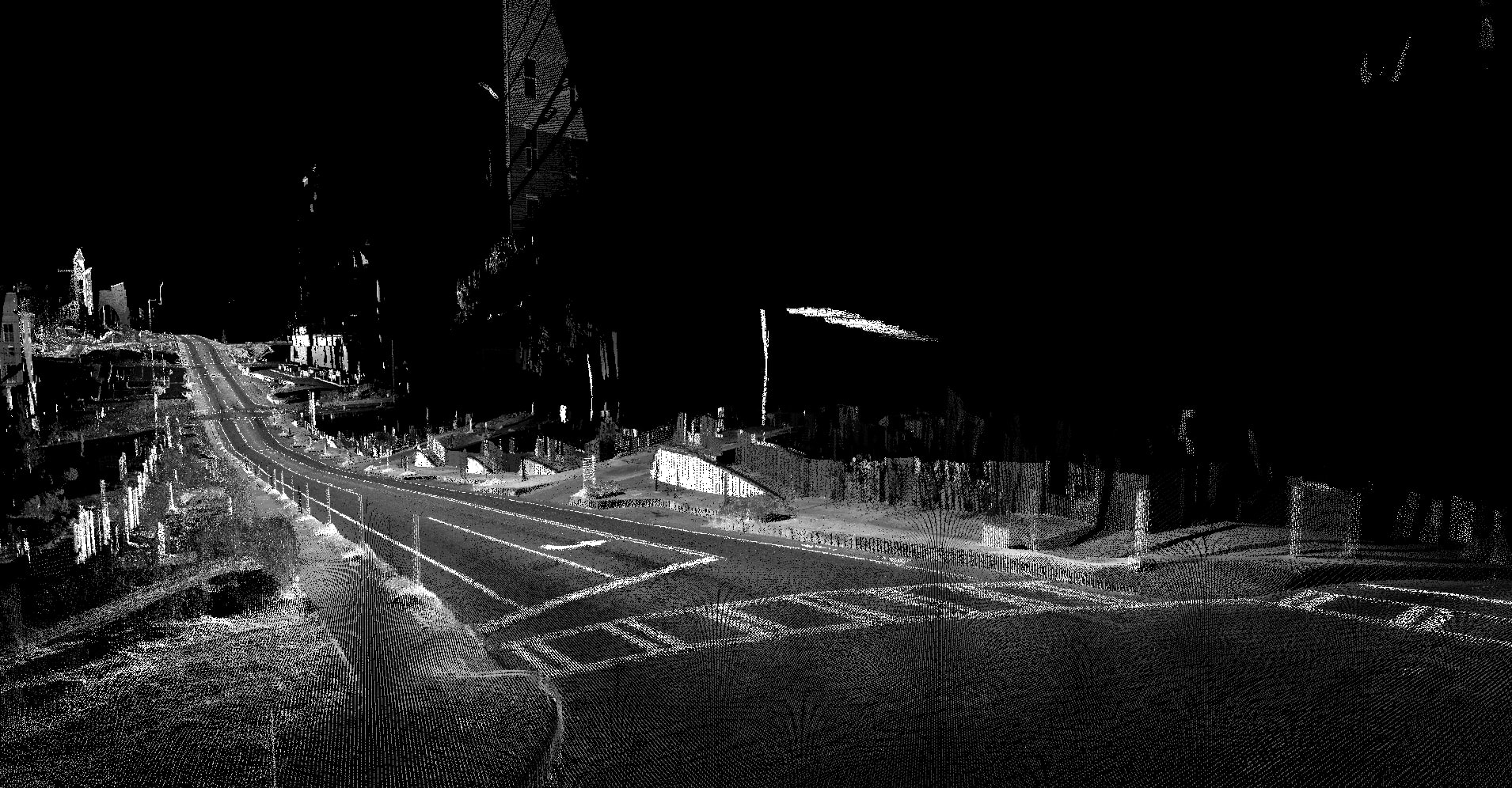
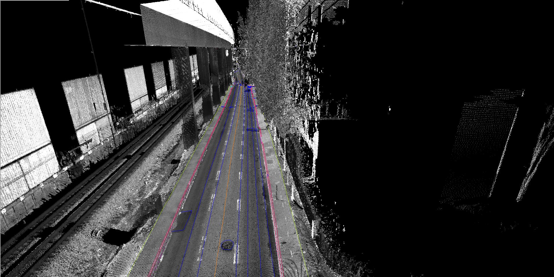
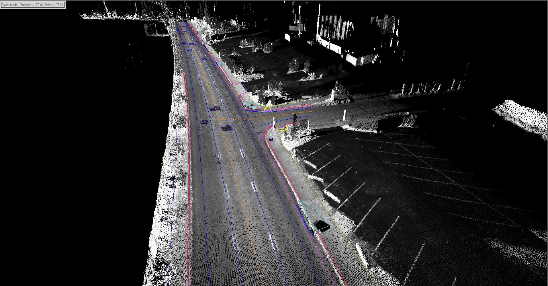
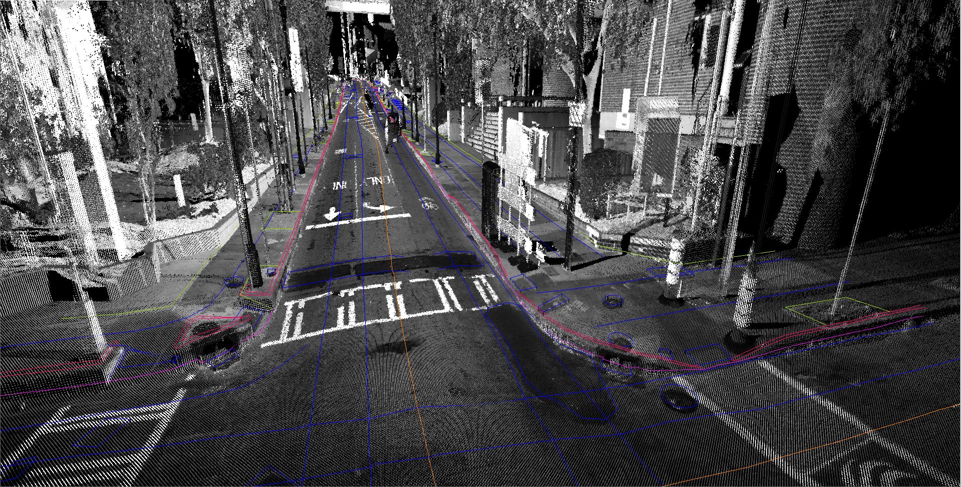
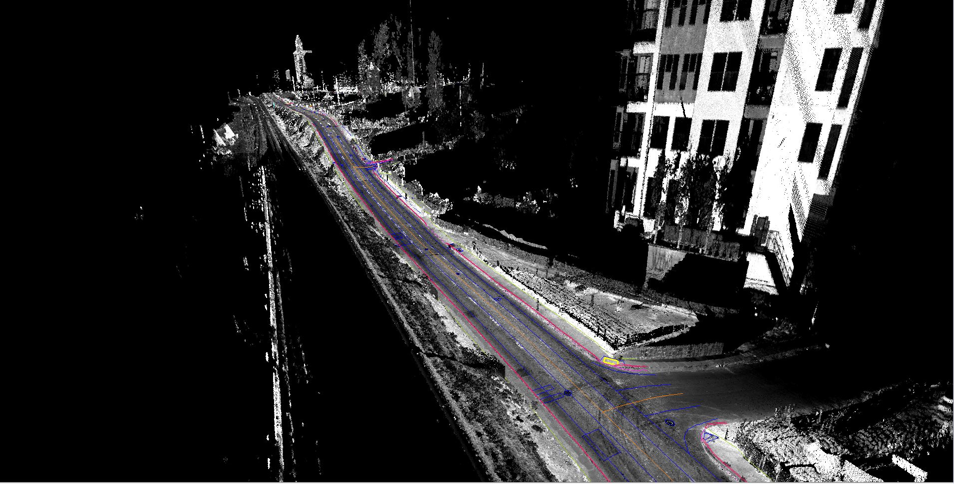
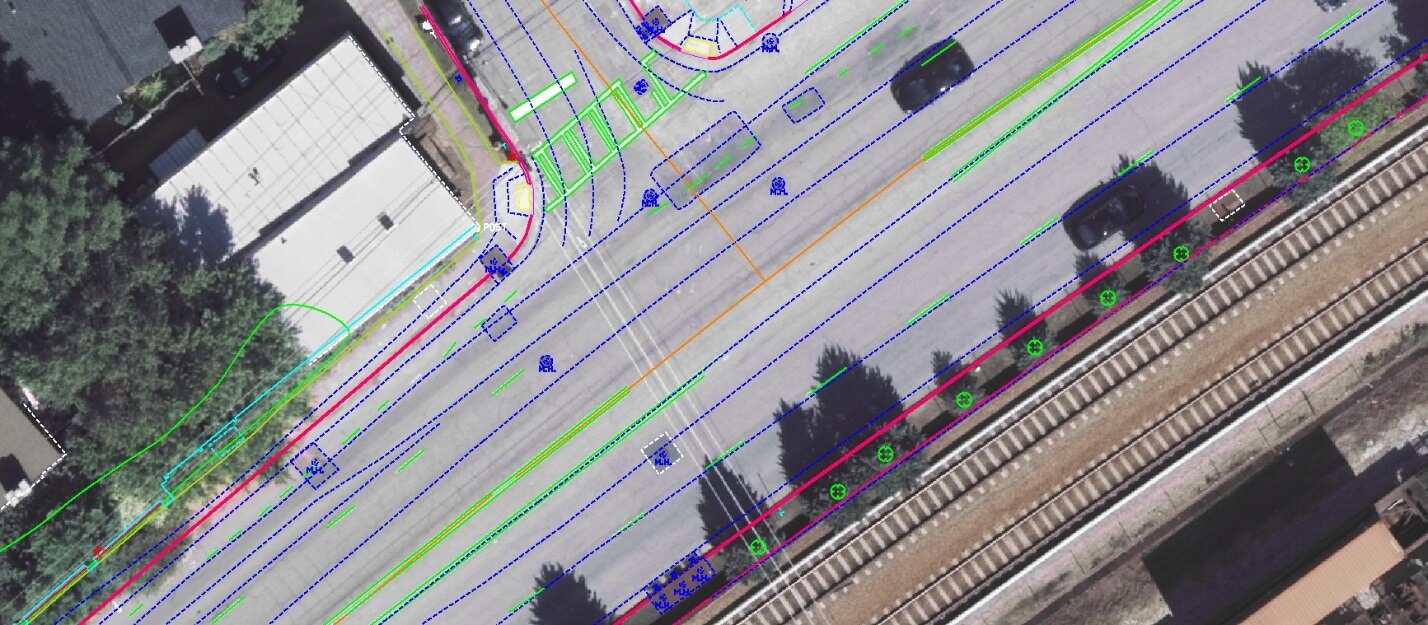
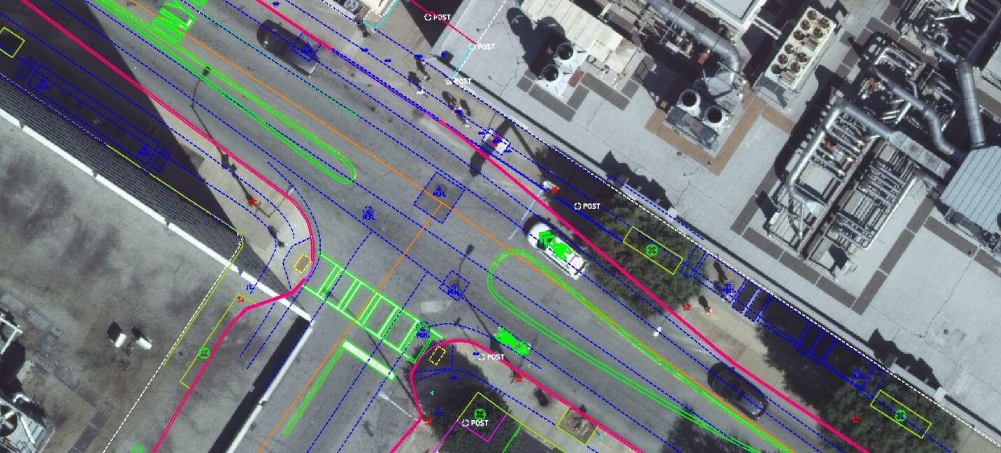
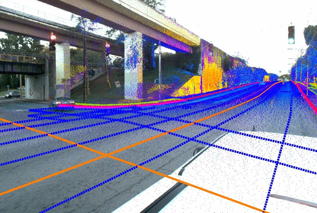
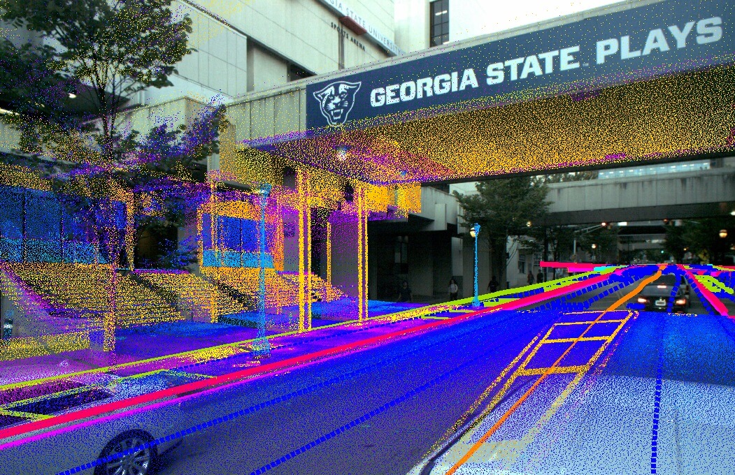
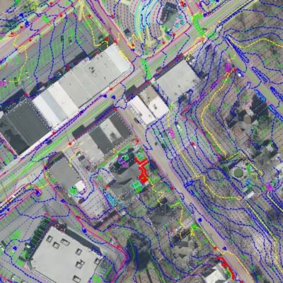
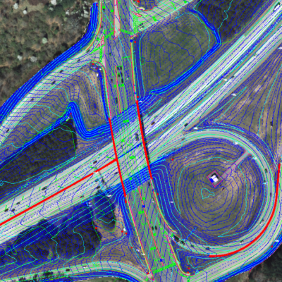
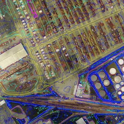
SCS provided a 3D point cloud and GDOT database mapping for 7 Miles of DeKalb Avenue. SCS used Mobile LiDAR and aerial mapping to collect all features, pavement cuts and anomalies over .08’. Mapping included metal covers, water valves, pavement cut outs from utility work and other non-traditional roadway features in database. The work required an extremely tight deadline within the limited budget. 3D point cloud was delivered so additional 3D measurements could be extracted in the office. The deliverables included a .2’ digital ortho, a 1” =20’ Microstation and Autocad file, along with an InRoads database with mapping accuracies of .06’.
Related Projects

© 2020 Settimio Consulting Services, Inc. All Rights Reserved.
Terms of Service | Privacy Policy
Terms of Service | Privacy Policy
Connect with us: