
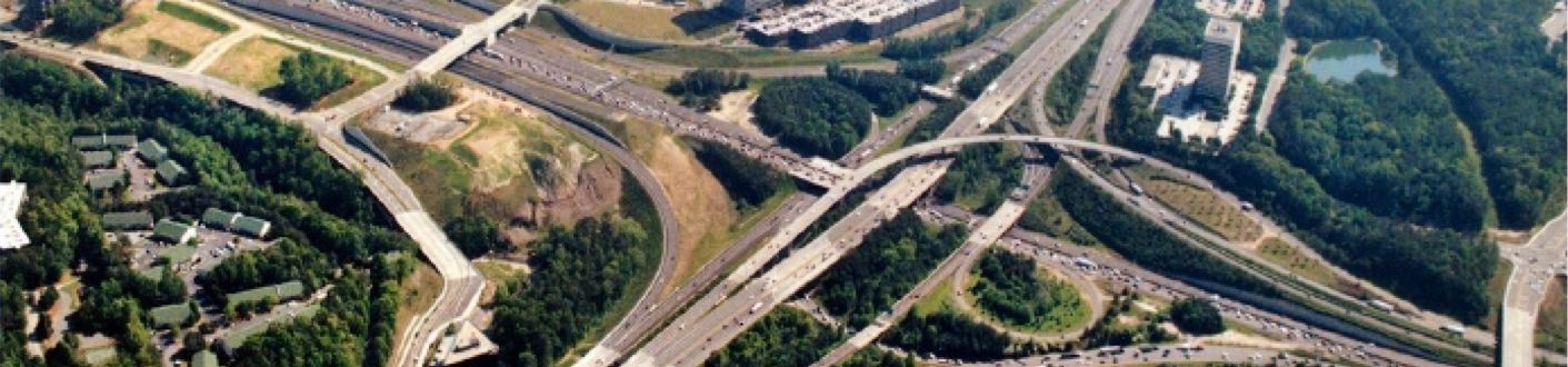
Northwest Corridor I-285


Northwest Corridor
Atlanta, GA
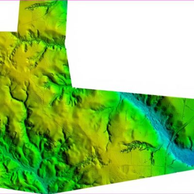
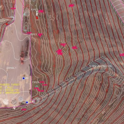
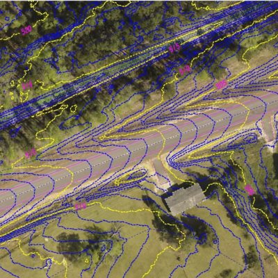
SCS was responsible for providing a complete mapping database in 180 days. The challenge was to provide a GDOT Engineering Mapping database and DTM data for over 26 miles of high-density multilane interstate in an extremely short time frame. The project was awarded in July 2013 when unfavorable conditions of having to deal with leaf on vegetation obstructed the ground and a schedule that would not wait for wintertime im-age acquisition. The project also required ground TOPO accuracy of .5′ with pavement accuracies better than .1′ and a high-resolution color digital ortho. The data needed to be accurate and collected quickly to meet the critical path schedule of downstream events that relied on good mapping and pavement data. SCS
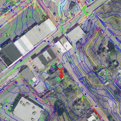
used modern LiDAR technology from different platforms including mobile and aerial to help resolve the challenges associated with this high-profile project with an aggressive schedule. Both Rotary Wing and
Mobile LiDAR platforms were used to determine the Relative and Absolute accuracy of the surface. Process, procedures and management of challenges are keys to the success of modern-day mapping. Proper planning and geodetic control along with sound fundamentals are key to the acquisition of data that accuracy can be used downstream for. SCS has developed processes and procedures for processing of the LiDAR data to meet accuracies of better than .1′ necessary to meet the required accuracy. Both relative and absolute accuracy require proper planning and procedures to have valid measurements as a framework for
future extraction. High accuracy for both relative and absolute measurements can be achieved with the right techniques. SCS delivered a Microstation and Inroads database with the appropriate GDOT EDG. The accuracy achieved for all road travel lanes and bridges was .02′ relative accuracy, 95% confidence factor of .06′ on pavement.
Though 3D engineering technology is emerging. SCS has been working with 3D point cloud data since 2010, even though it is still difficult and not fully exploitable by most mainstream software packages at the time the NWX Project NTP were initiated. SCS had the expertise to manipulate and manage large point cloud data sets and produce actionable Engineering information.
Challenge: Collect and deliver a GDOT specification Microstation and Inroads database on a tight schedule.
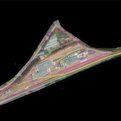
Response: SCS collected Aerial LiDAR and imagery data for the entire Roadway corridor delivering Planimetric mapping data and Inroads database R/W to R/W of the entire Interstate corridor in 75 days. With the full mapping limits that included sideroads and expanded geographic areas required by the project in 150 days.
Challenge: Project Management of a large project interfacing and communicating clearly with the project two survey firms and the project engineers.
Response: Initial weekly progress meeting with the Prime were scheduled to maintain high frequency formal dialogue to ensure schedules were being met and unexpected challenges discussed. Meetings were than scheduled at longer intervals. Direct interaction with the project surveyors including key SCS staff. Office visits minimized project time obstacles by determining efficiencies that were unexpected due to the nature of the 3D data SCS had collected. The ownership of SCS was directly involved with the Project including meeting with the design team key managed and technical staff to ensure a successful execution and delivery of a completed engineering design grade survey database.
Unexpected Challenges: At the end of the project deadline, the project surveyor for one of the survey firms involved unexpectedly passed away leaving the Survey firm without key information and technical skill when the delivery deadline was 45 days away. SCS took initiative and visited the project engineer’s office and the survey engineer’s office when it was decided that SCS should place Key employees and technical staff in both offices to help the new project surveyor to transition into his new role and offer technical expertise the sur- vey lead lacked in producing the final deliverable. No additional compensation or scope revision was requested by SCS or received.
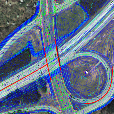
SCS’ additional value: After SCS completed its task, a request was made. The prime wanted to add an additional lane to the project but was uncertain if there was sufficient room under the bridge of I-285 off I-75. To determine this, the surveyor requested a scope change that would cost additional fees, take time to procure, and would delay the schedule. SCS used its access to off the shelf mobile LiDAR data and measured the low beam and distances between bridge piers, gave the information to the design team to make the evaluation without an increase in cost or impact on schedule.
Related Projects


Terms of Service | Privacy Policy